Road trips were never my thing. The thought of having to sit a car and watch countless hours of the same scenery over and over again never appealed to me. This was different; I’ve never breathlessly exclaimed the word “wow” to myself so many times in my life. Meandering through mountains, farms, small towns, cities, deserts, forests, and more, the sights along California State Route 1, also known as the Pacific Coast Highway (PCH) are truly some of the most beautiful in California. In fact, I’d venture to say that the views are some of the best in the entire United States.
When I was in high school, I saw a documentary on the PCH on the History Channel after school. The fascinating stories and final triumph of its construction stuck with me. I dreamed that, one day, I would drive this beautiful road and see all of its views. However, the realities of life caught up to me, and, as the years went by, I would either drive the fast way on the I-5 to get between San Francisco and Los Angeles or I would fly. Now, with my career on hold, I decided that it’d be now or never. So I did it.
I drove down Route 1 in two days, but I wish I had taken a third or even fourth day. Technically, the PCH joins with and branches off of a number of numbered freeways, but most of it is on Route 1. There were so many amazing-looking places where I wanted to stop but couldn’t due to time constraints. Along the side of the plethora of winding turns on the road, there are many places to pull over and take pictures from. For anyone with an interest in nature, there is so much variety as you drive down the coast that you’ll never get bored.
If you’re going to do a road trip somewhere, the Pacific Coast Highway is way better than anything else.
So, just how good is the drive from San Francisco to Los Angeles along the coast? Let’s rewind a bit. In 2006, I decided to join some friends doing a summer job for the Southwestern company selling books door-to-door in Maryland. Our journey began in Los Angeles and took us across all the cities and towns along the I-40 and banked north on the I-81. We drove until we reached Rockville, Maryland. Driving across the country was pretty nice, but if you’re going to do a road trip somewhere, the Pacific Coast Highway is way better than anything else.
After leaving San Francisco on Route 1, I was are greeted by the tiny beach towns of Pacifica and, further down, Half Moon Bay; the journey had only just begun.
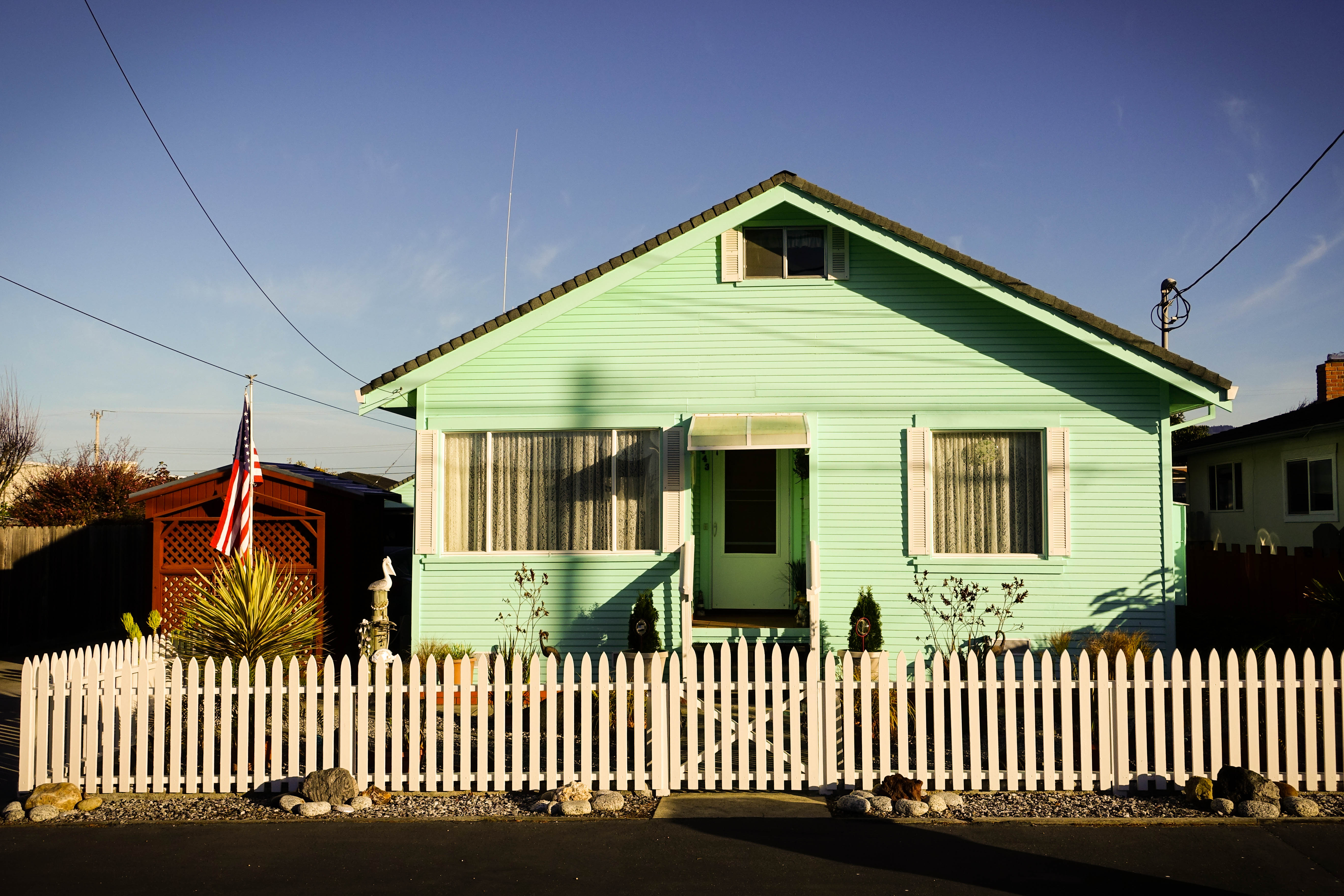
Poplar State Beach sits at the southern tip of Half Moon Bay and right before the Ritz-Carlton. Colorful houses, some with white picket fences, lead up to the beach.
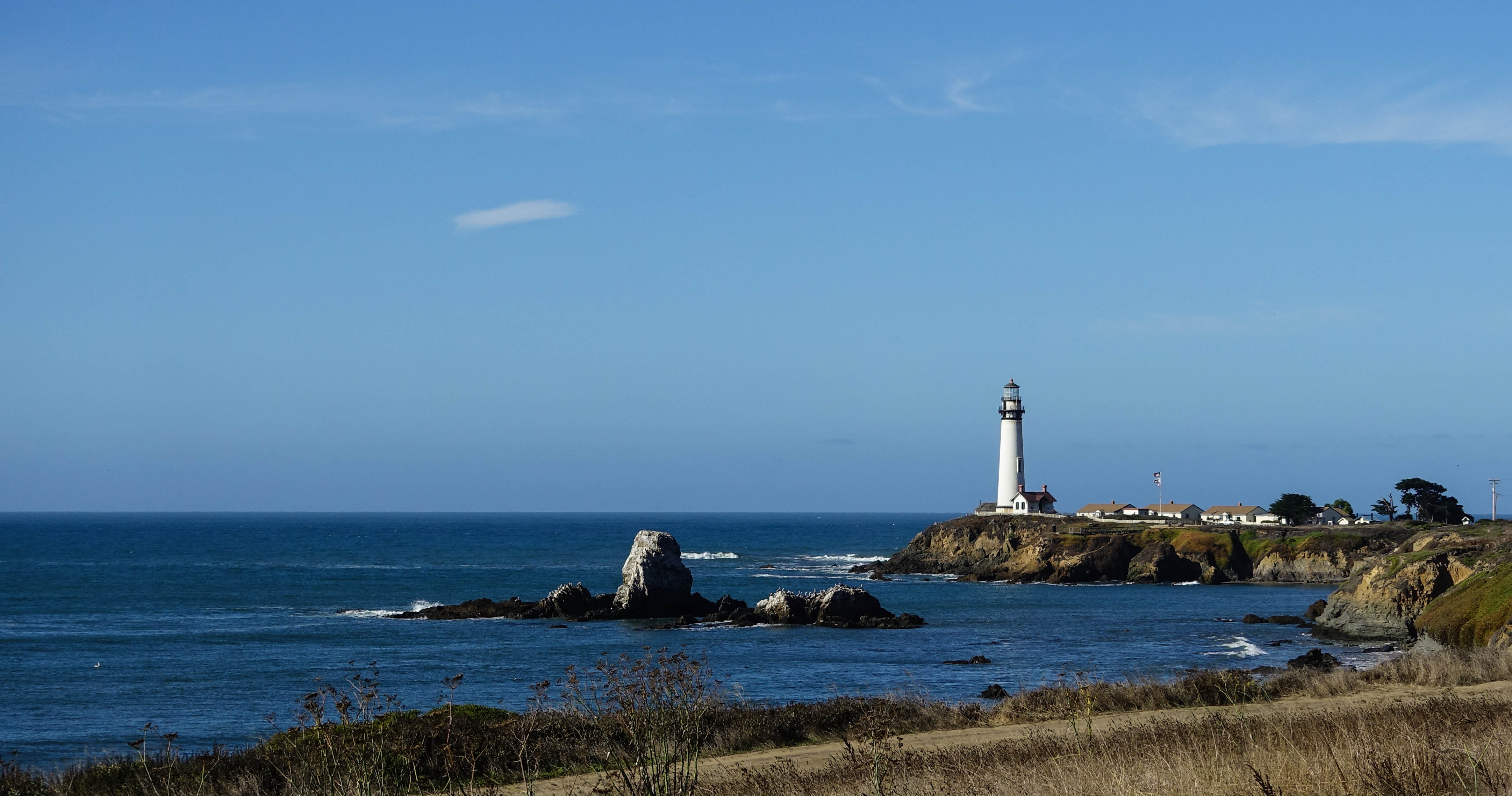
As I drove a little further down the coast, I stopped at Pigeon Point Lighthouse, a popular landmark. Built in 1871, it has now been converted into a tourist information center, shop, and hostel. The hostel has 4 buildings overlooking the ocean, and each building has one private room and three shared rooms with 6 beds each. I met Joe, one of the front desk staff. He was from Santa Cruz and now lives and works at the hostel, and on his days off he often goes fishing around the area. Seems like a relaxing life.
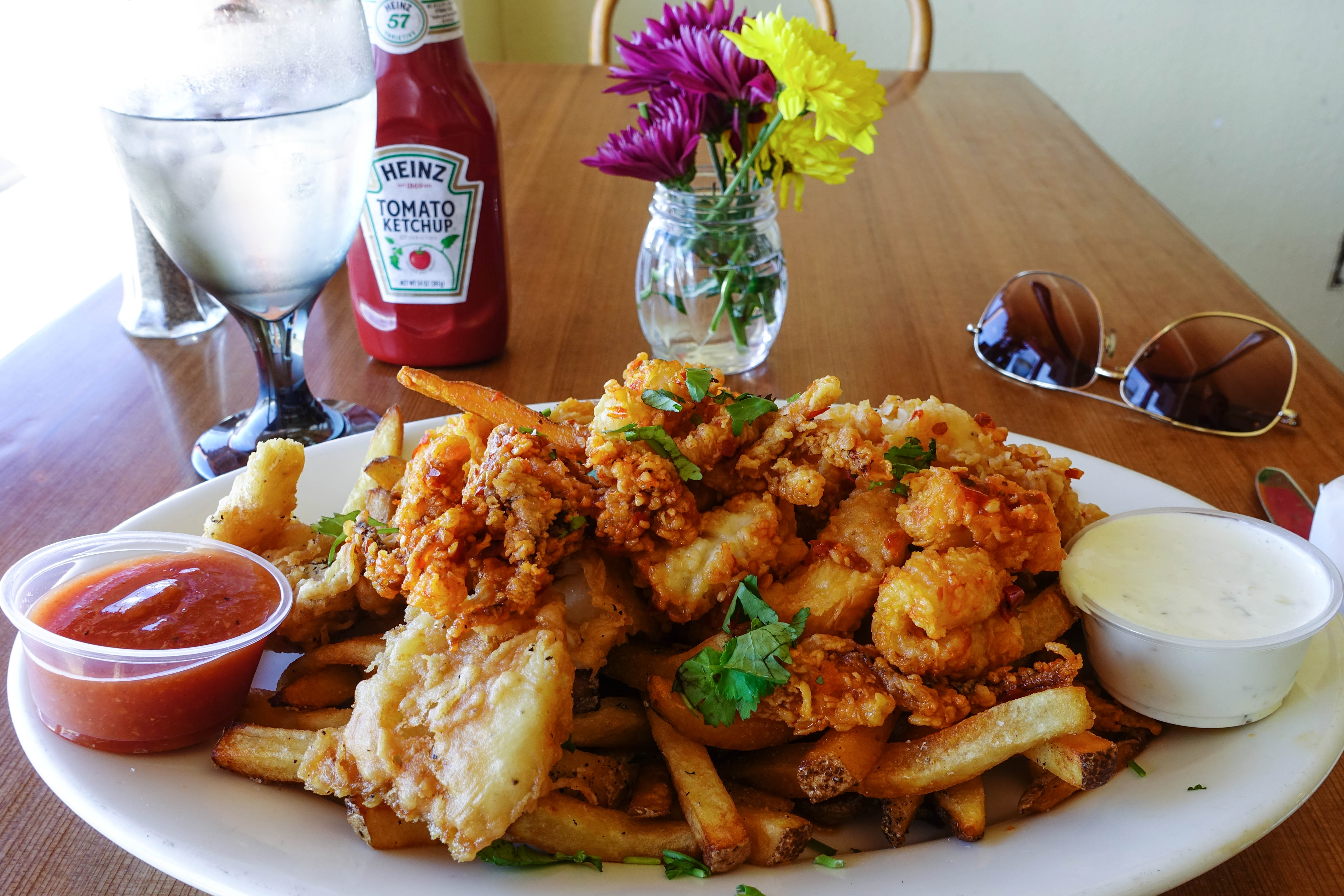
I stopped for lunch in the town of Davenport, which basically had two restaurants on the main road leading through the town. There was a big, popular restaurant and a mom-and-pop-looking place across the road from it. I chose Davenport Cafe, the mom-and-pop-looking restaurant, because I think I might be a hipster. Needless to say, the lunch that I ate was one of the best things I’ve ever had in my life. I ordered their special, which was a seriously gigantic plate of lightly fried fish and chips, topped with spicy garlic calamari.
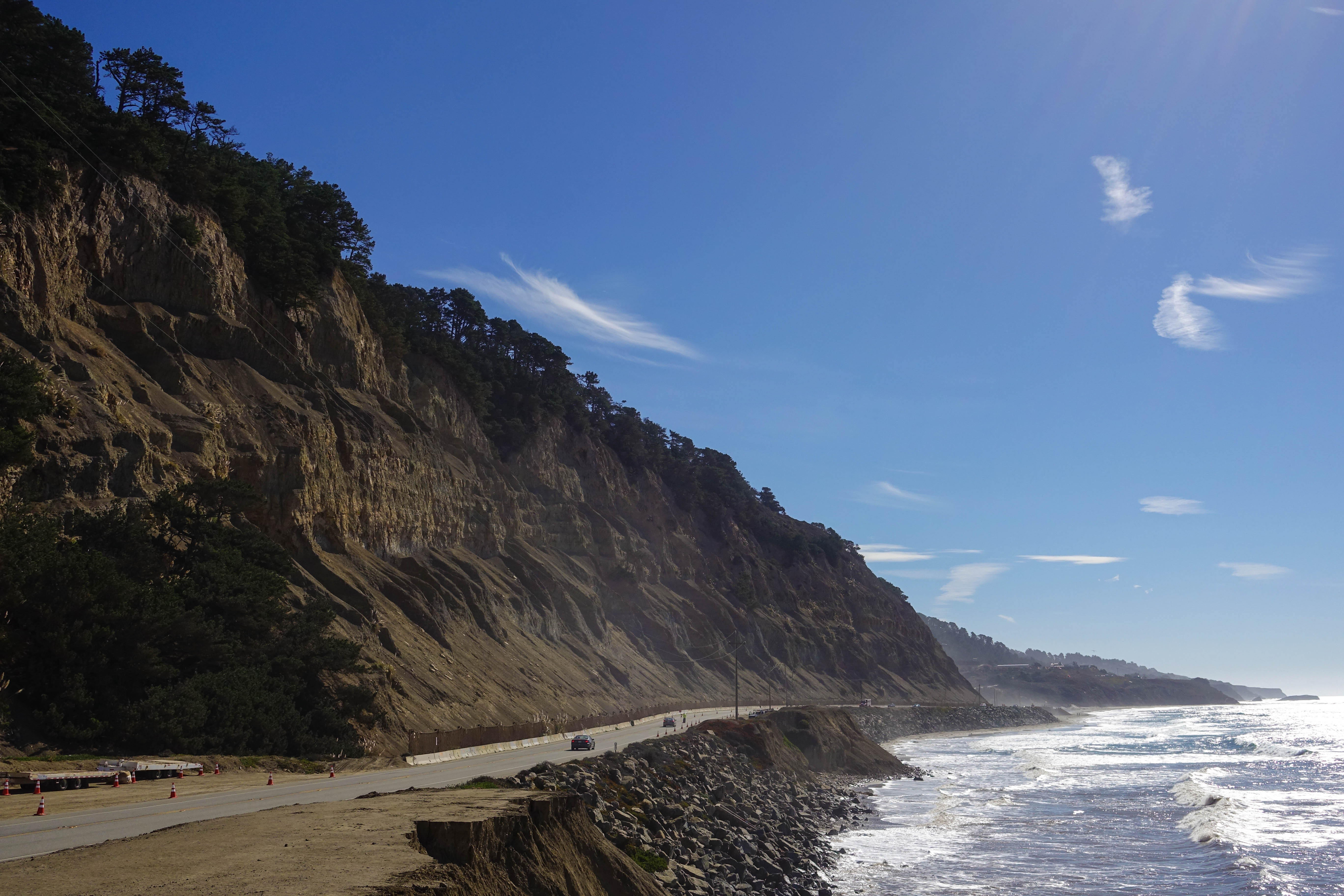
Stuffed, I hopped in my car and continued my journey past the seaside farms and cliffs just south of the town. The roads widened as the city of Santa Cruz neared, and I passed through without stopping, longing for something a little more scenic.
I didn’t have to go far. South of Santa Cruz, the highway lanes thin once again and the road weaves through rolling mountains and sharp cliffs. A single cloud rolled in from the sea, creating a light fog that illuminated the morning sun. It briefly draped itself over the rolling hills ahead, but dispersed as quickly as it had come.
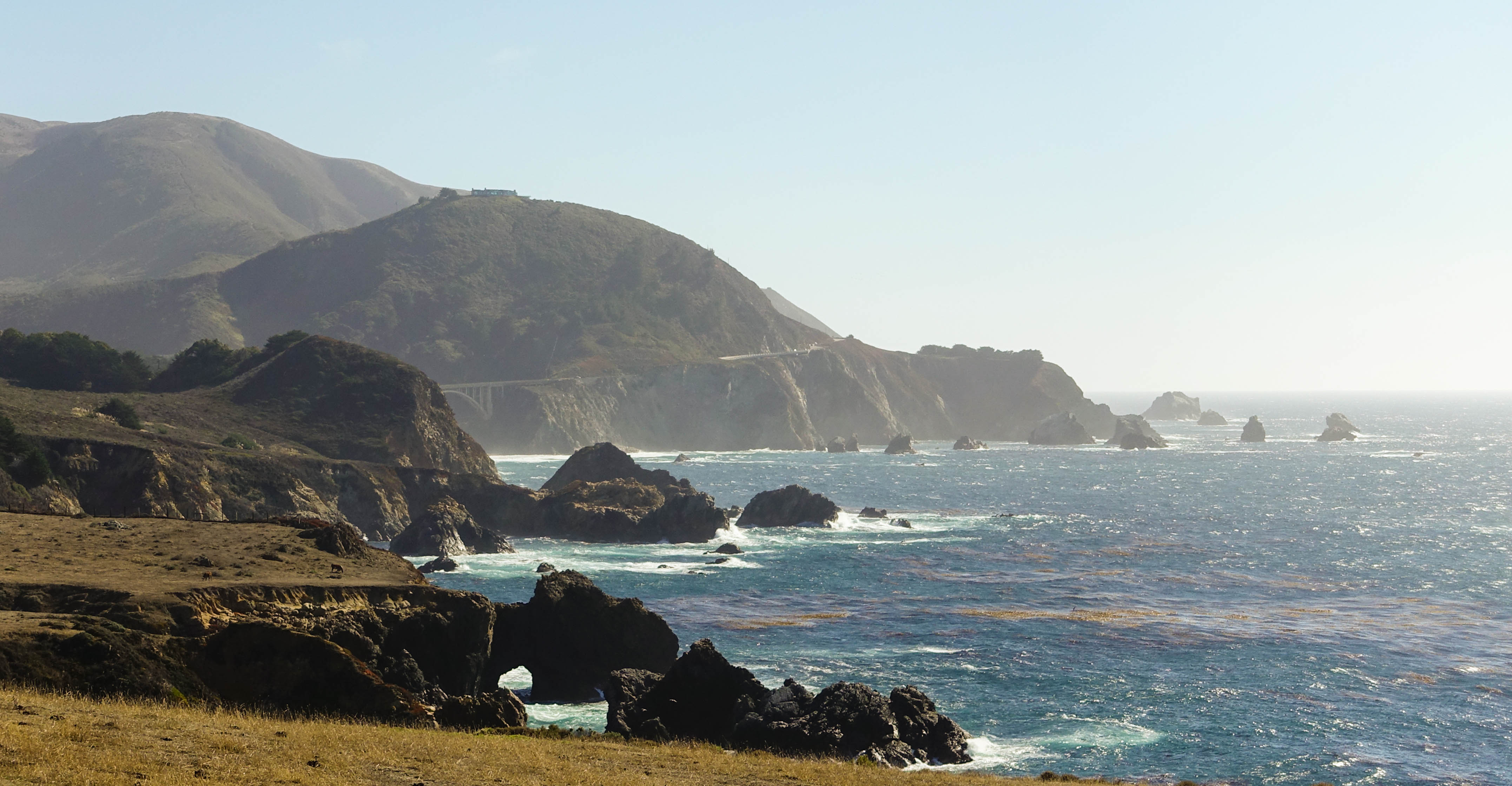
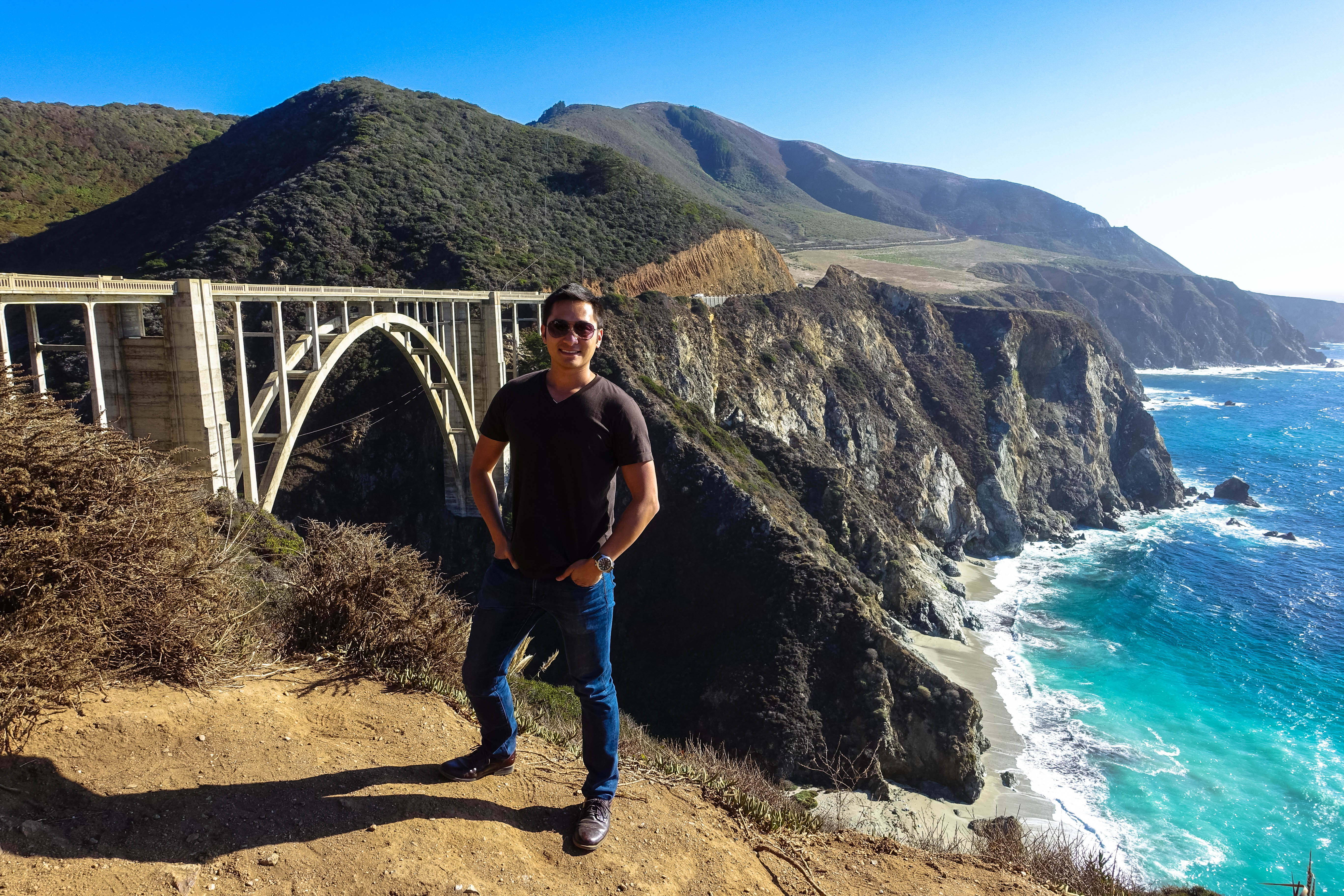
Hours flew by as I drove, made countless stops, and even turned around a few times just to get a second look at a few spots. Five hours in, everything was so fresh and new and beautiful, but one place that really took my breath away was Bixby Bridge. Completed in 1932, Bixby Bridge spans across two steep cliffs and extends out between them, gently curving to the right as you cross it from the north side.
South of Bixby Bridge lies a very different scene. I was unexpectedly greeted by the lush, tall trees and signs for campgrounds for a few miles in Los Padres National Forest. After leaving the forest, the most interesting part of the drive began.
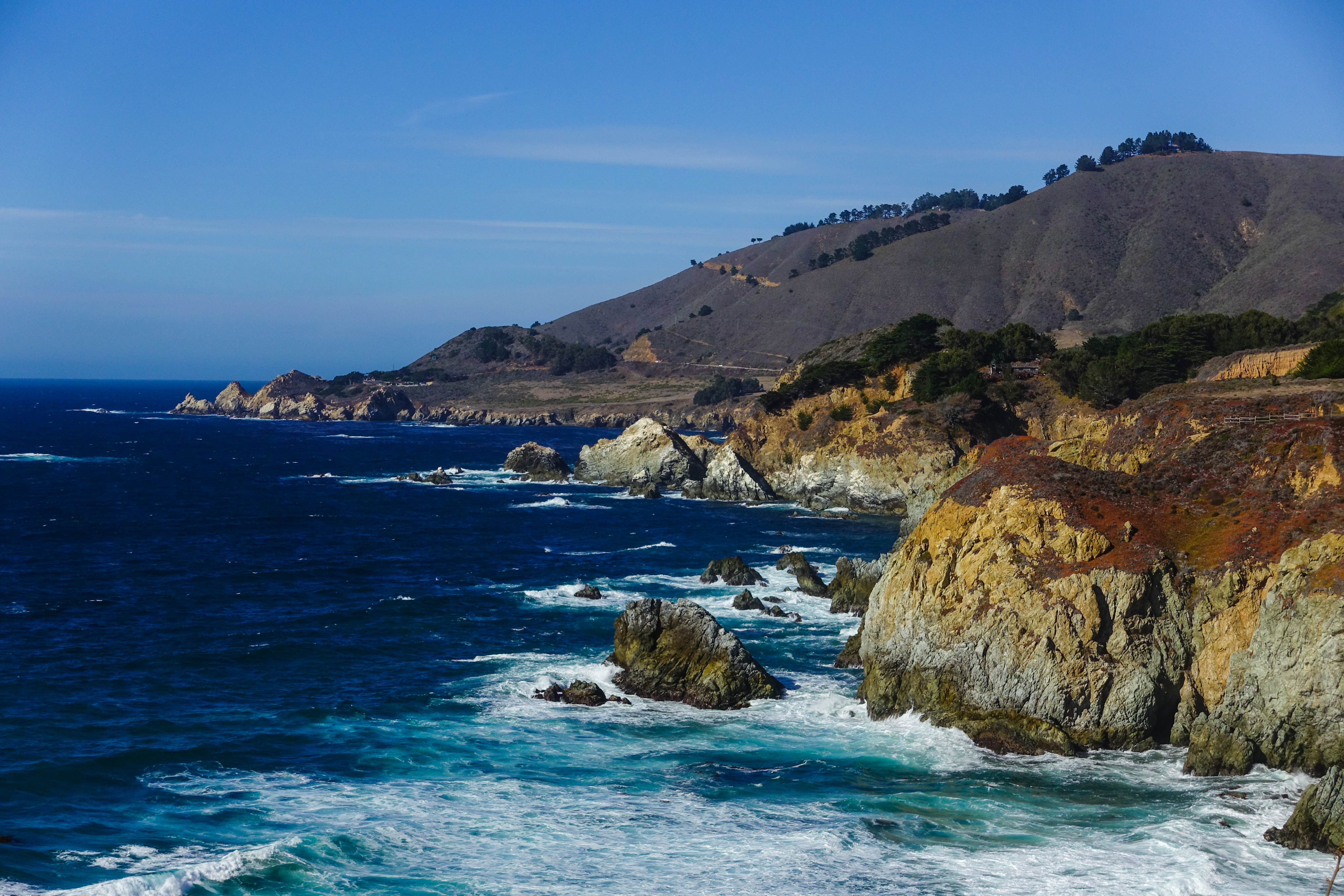
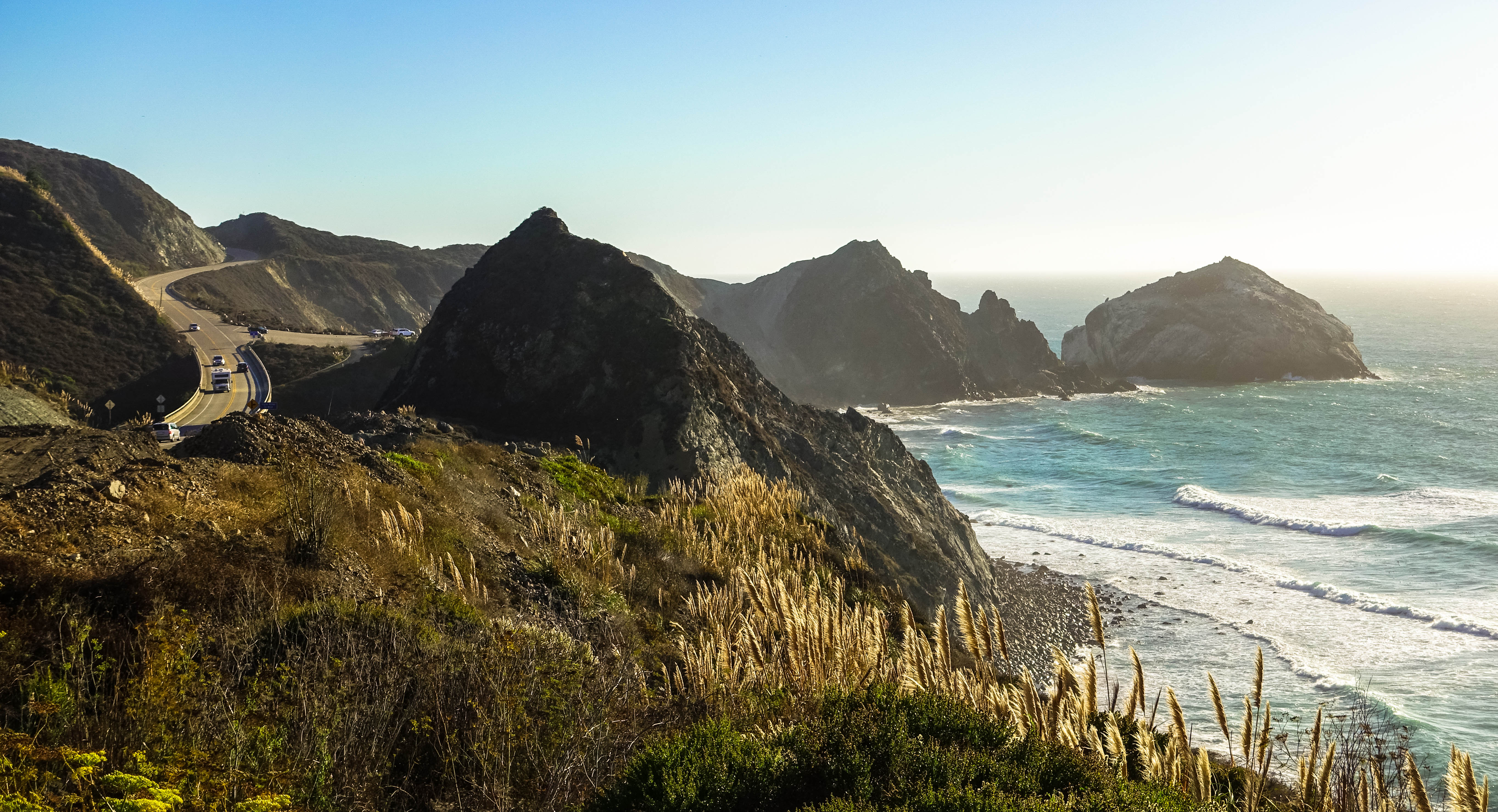
As I pushed forward, the mountains ahead became much taller, the single lane narrowed, and the shoulder started to shrink until the guard rails were up against the side of the lane. Here, the road became much windier than before, with a series of decreasing-radius turns and switchbacks, sometimes becoming disorienting on a downward slope because the ocean was staring right at me over the guard rail. In the ocean, large rocks stood sharply, defiantly out from the water, creating a sparkling white surf as the waves rolled by.
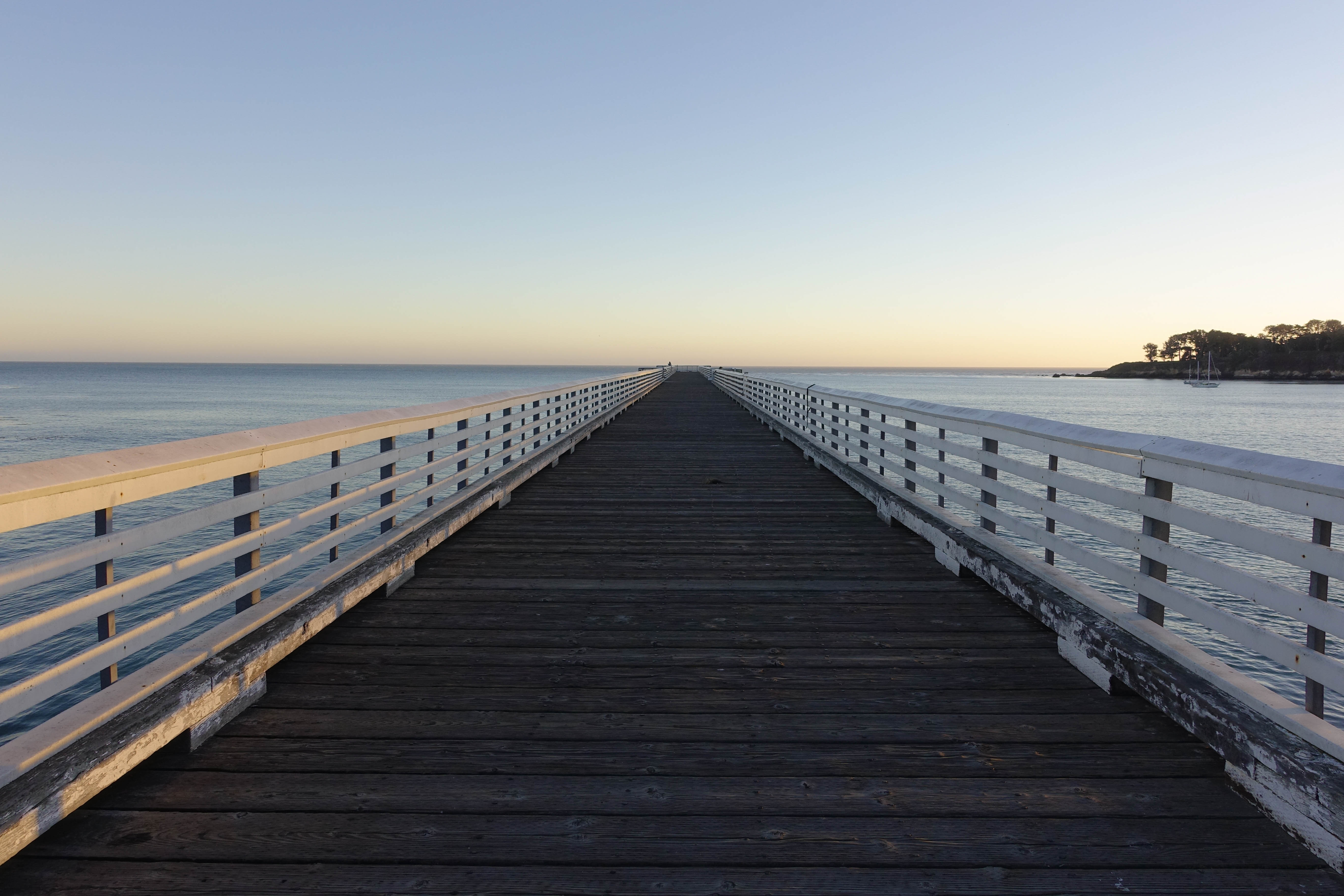
The sun was setting rapidly as I sped forward to reach my rest stop at Morro Bay. I made one stop at the pier across the street from Hearst Castle. I wasn’t able to enter the castle since it was already closed, but the pier at sunset was beautiful.
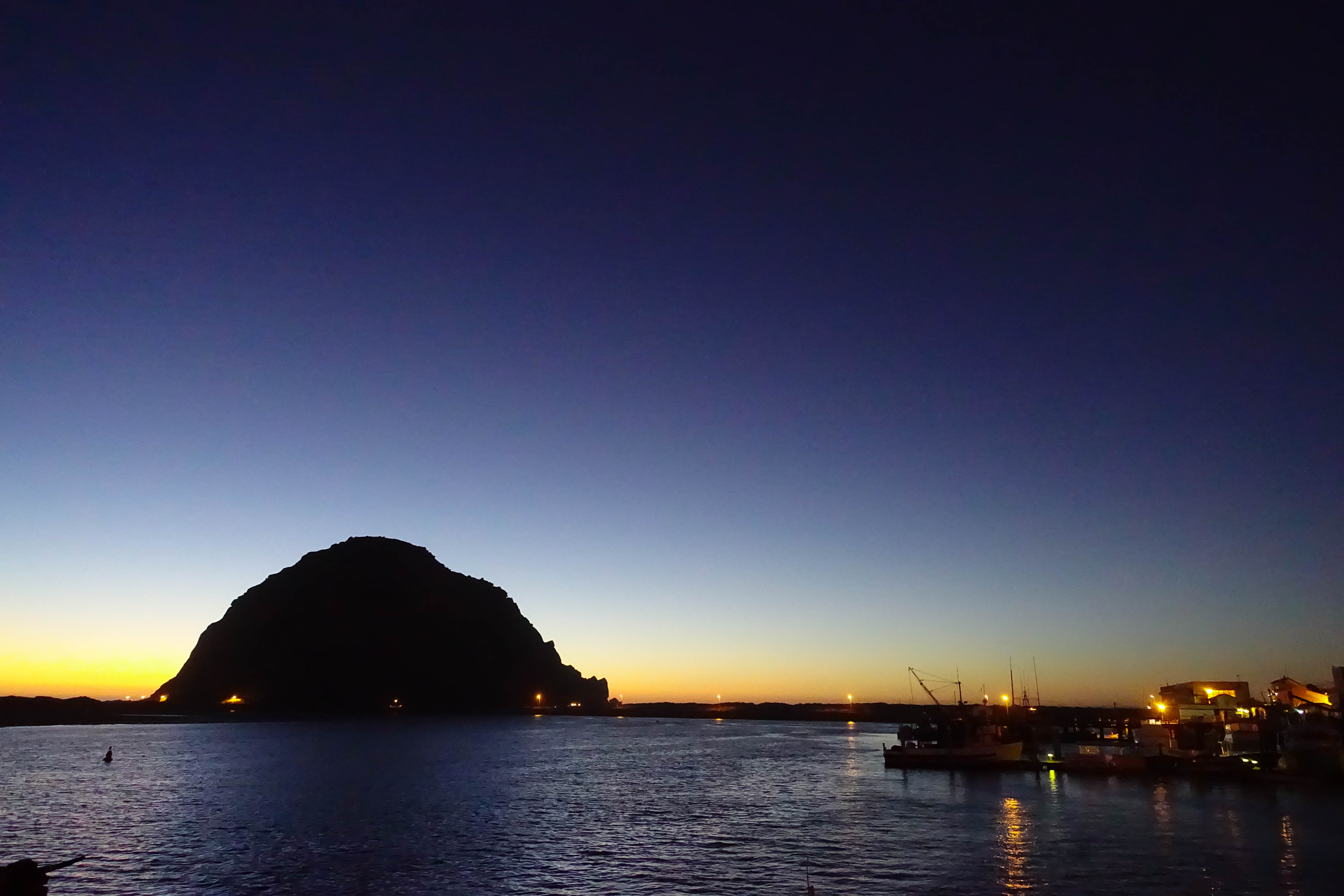
After the pier, I continued onward towards Morro Bay. The road was relatively straight, but sometimes changed elevation rapidly. As the incline I drove up gradually turned into a moderate decline, the town of Morro Bay came into view, with Morro Rock standing tall out of the bay. The sand on the beach next to Morro Rock was soft and powdery just like the sand in my hometown of San Diego, and it reminded me of the many bonfires that my friends and I would have on the beach when we were younger. I grabbed a quick bite to eat (generic, very forgettable Mexican food), checked into my hotel room, and got some rest for the night.
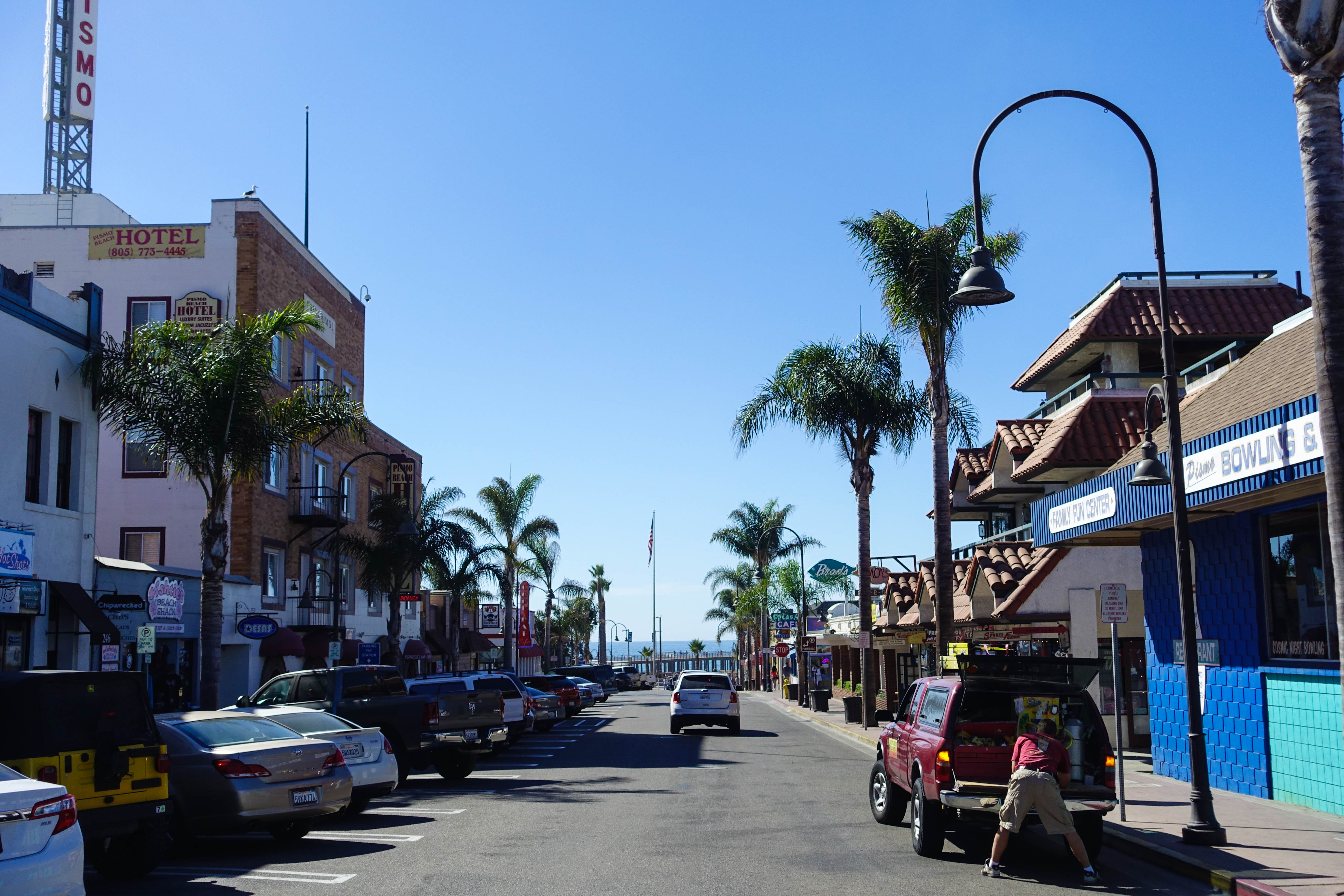
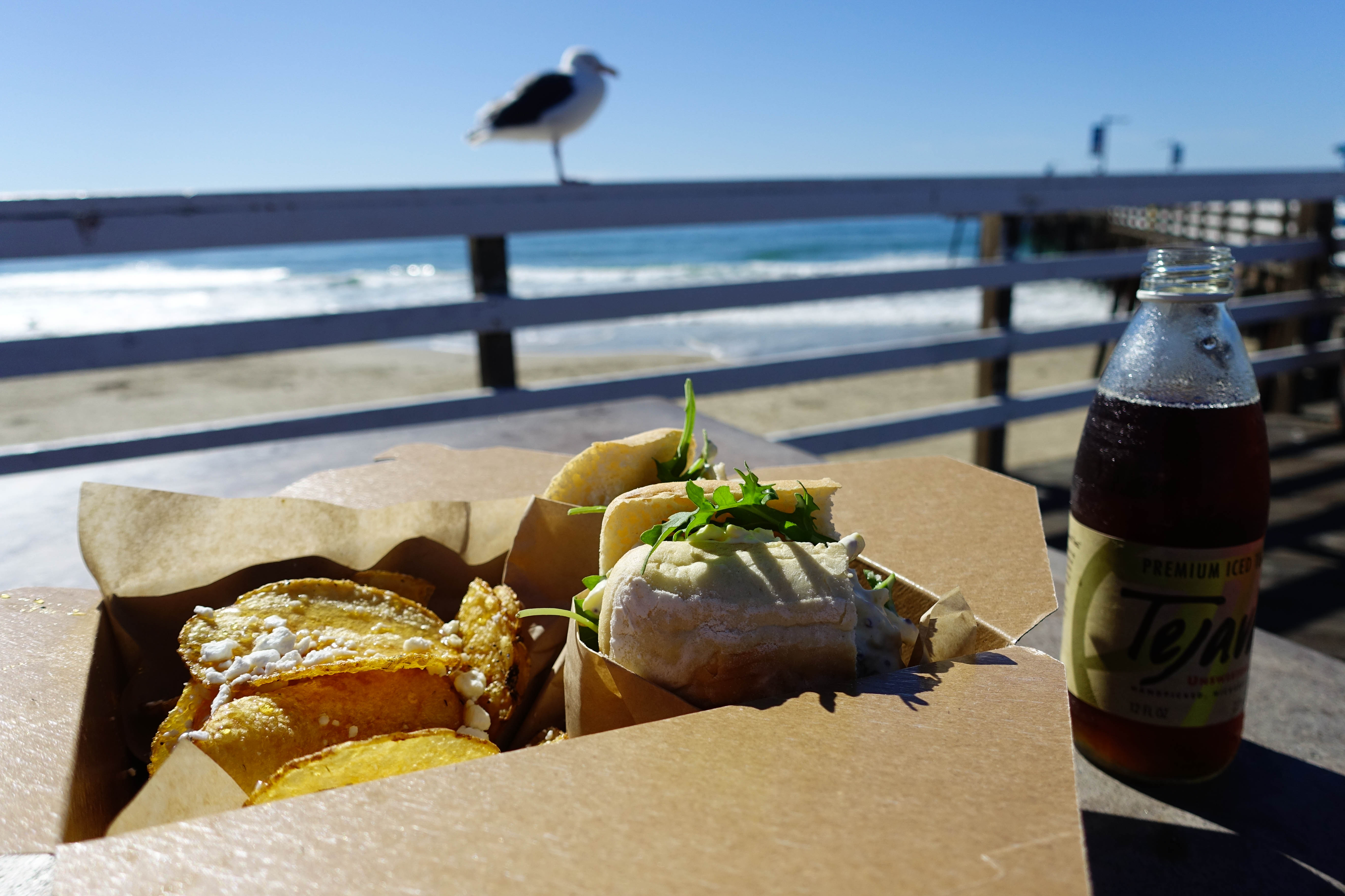
Morning came and I awoke to the gentle sea breeze blowing through my hotel room window. It was time to continue the adventure! About an hour south of Morro Bay lies the city of Pismo Beach, where I decided to stop for brunch. A number of restaurants, shops, and dessert places line Pomeroy Avenue, perpendicular to the PCH, which leads to the Pismo Beach Pier a few blocks down.
A ton of people who I asked in the area recommended that I check out Chipwrecked, which specializes in freshly-fried chips (not the British kind) and sandwiches. I ended up ordering a truffle egg-salad sandwich and a side of lavender salt and honey drizzled chips. It was a beautiful day, so I decided to take it to go and eat it on the pier. For the first time in a very, very long time, I felt at peace.
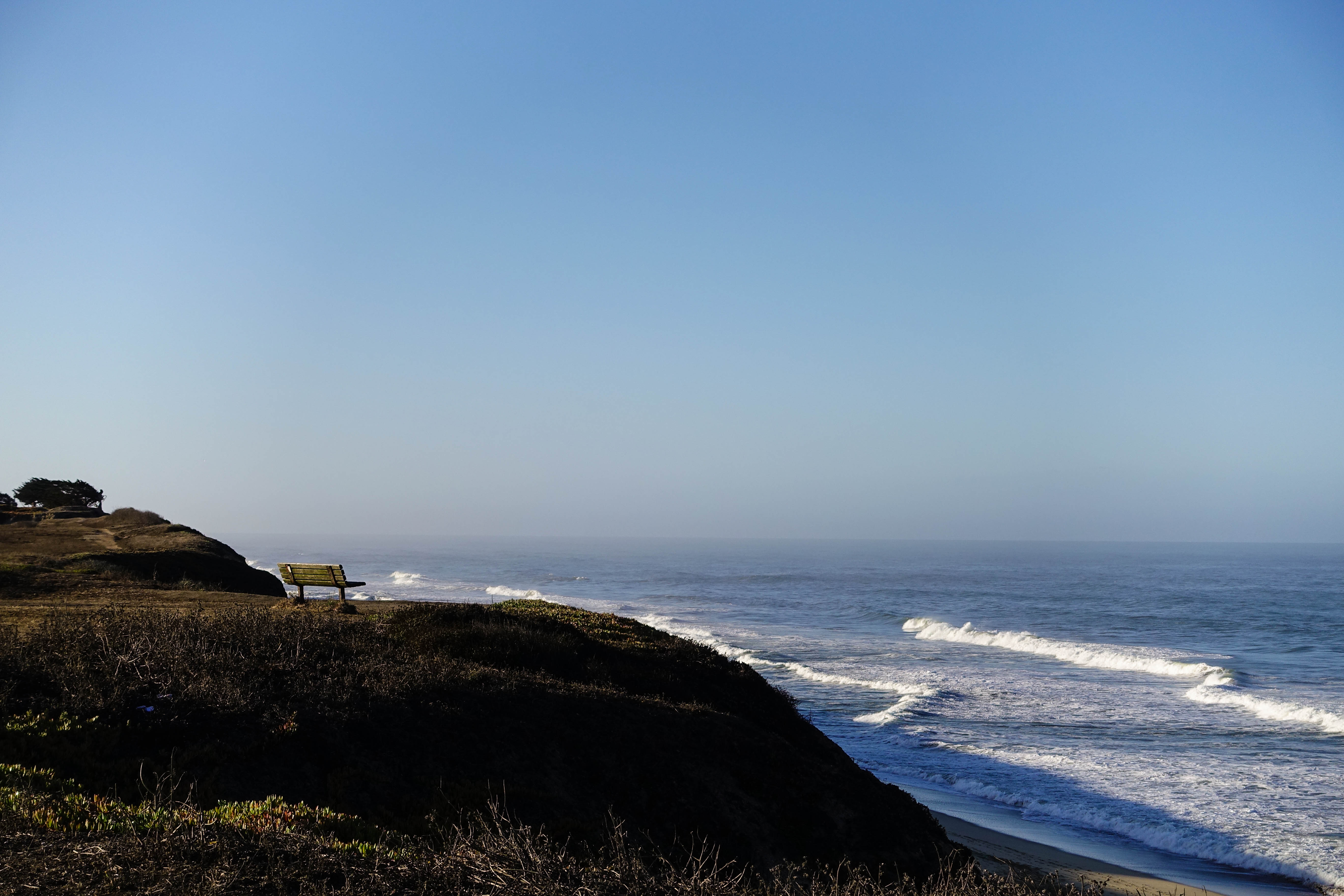
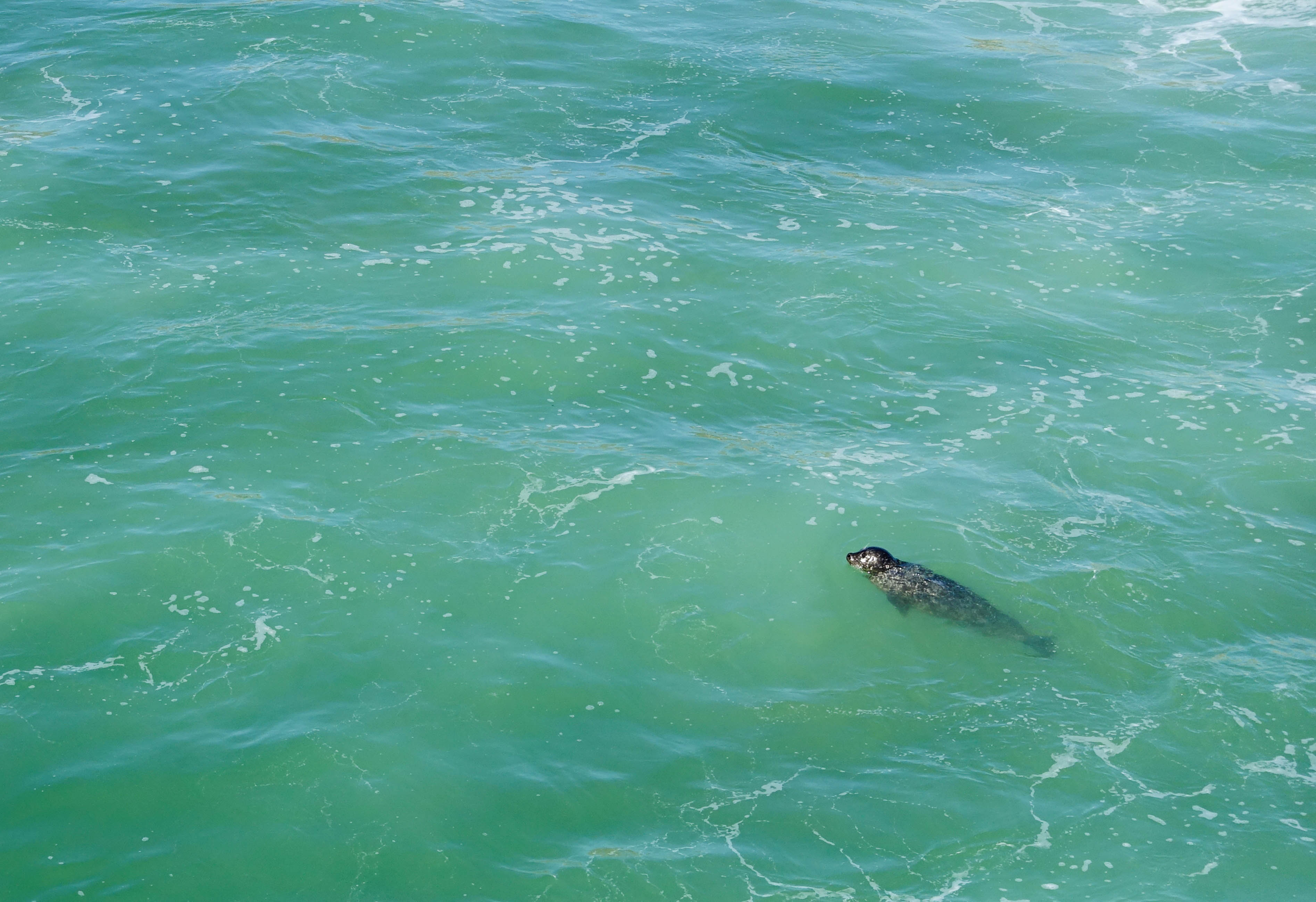
I stayed there for an hour, just taking in the scenery. There were birds, surfers, and I also spotted a seal. I wanted to stay longer, but I had to go.
There were still many miles to cover before I reached Los Angeles.
I realized I had entered Southern California because everyone on the freeway started driving at least 15 miles per hour over the speed limit.
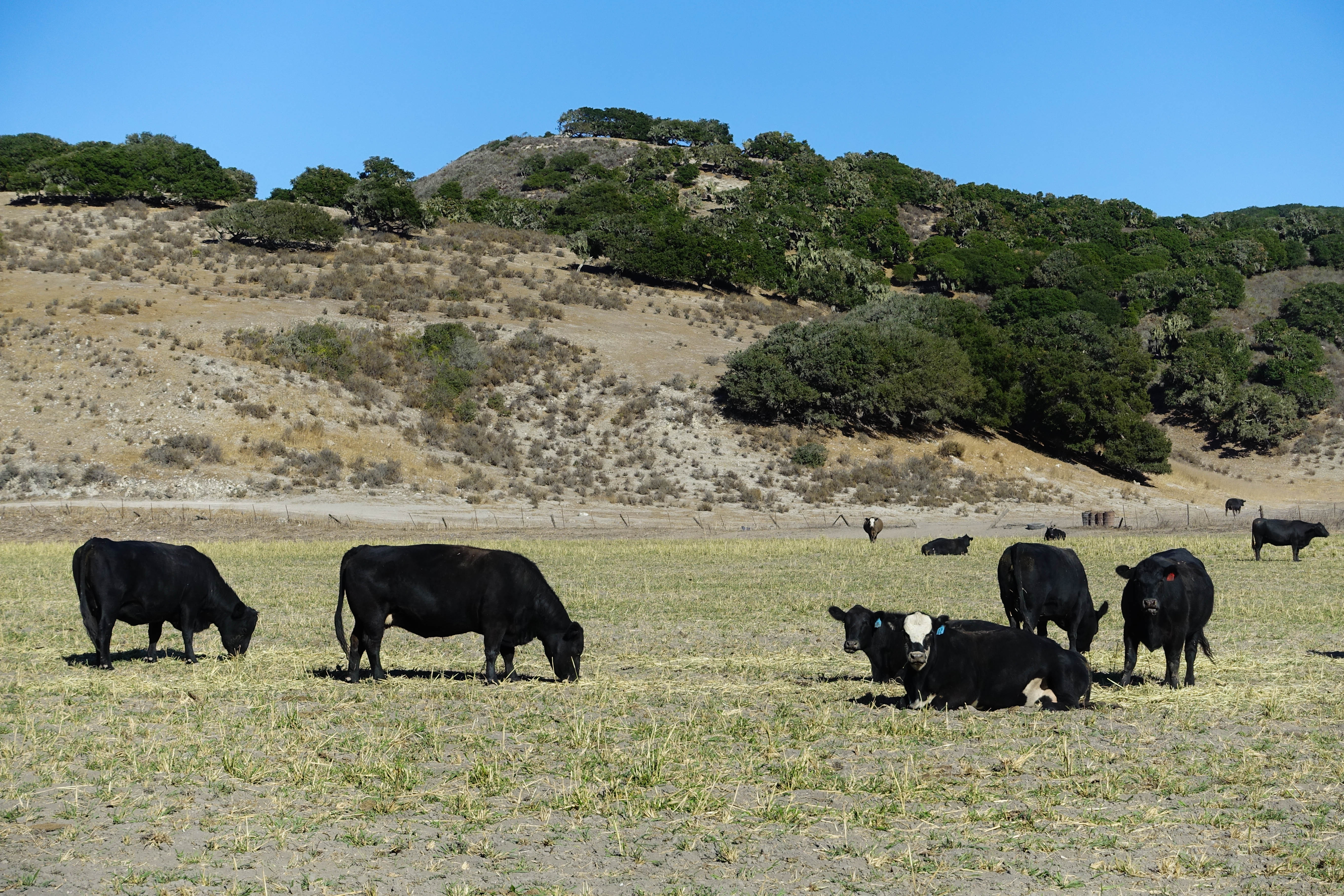
Much of the drive south of Pismo Beach was through desert, past some cows, and over rolling hills, but these were things I had seen before. At some point, I realized I had entered Southern California because everyone on the freeway started driving at least 15 miles per hour over the speed limit.
The roads were relatively traffic-free until I got to Santa Barbara. After Santa Barbara, I steered the car towards Malibu, and headed towards Point Dume, a cliff on a beach where many studios shoot movie scenes and commercials. In fact, a crew was out filming when I pulled up to the parking lot. The entrance to the beach is $6.
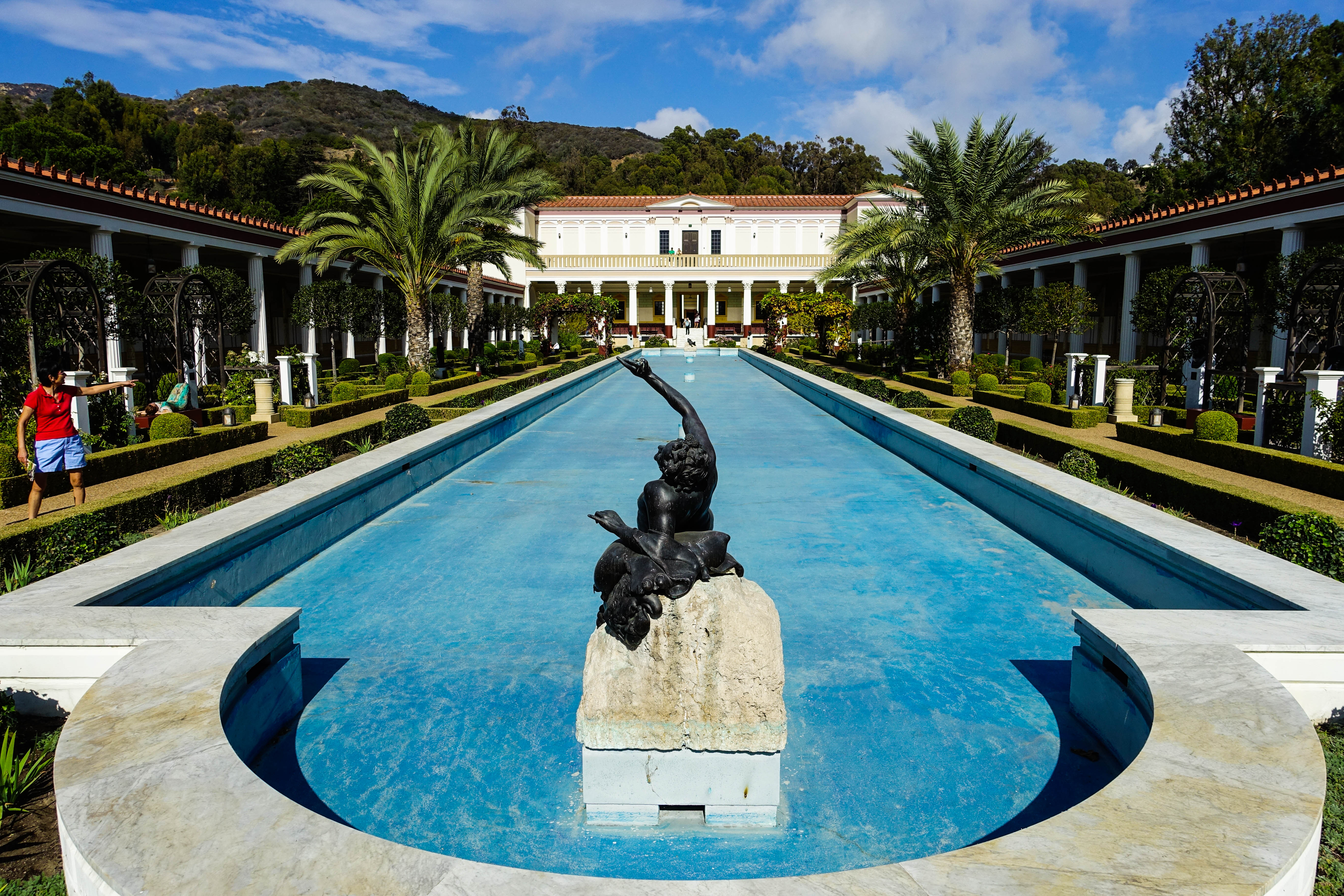
After Malibu, I continued down the PCH and stopped at the Getty Villa museum. A reservation is required (free) to enter, and that can be done on the website, but parking is $15. It’s a beautiful place to relax, look at some ancient artifacts, and learn about different cultures and civilizations. I stopped by for an hour before I completed the last leg of my journey down the coast into Los Angeles.
The 6-hour drive on the main inland freeways (like the I-5) between San Francisco and Los Angeles always leaves me exhausted. On the PCH, After around 18 hours of driving, stopping, hiking, taking photos, and singing in my car, I was a little tired, but I certainly wasn’t exhausted. I felt a little different from the way I had felt this trip; I’m not sure what it was, but perhaps I felt more energy and clarity. Through this journey of stops and starts, detours and dead ends, grand panoramas and simple pleasures, I felt as though I was just a little bit more able to take on the world.